On a rainy, quasi-miserable day we drove from Halifax to Cape Breton Island of Nova Scotia. I believe I came here as a kid, but would need my parents (or their photo albums) to fact check that. Alas, I have neither. In any event, when we mapped out our Nova Scotia plans, we decided to include Cape Breton Island, the furthest most northeast corner of Nova Scotia, as I’d read about the Cabot Trail in the book 1,000 Places to See Before You Die.
The native people (ancestors of the Mi’kmaq) inhabited the island first, but the first European explorer to land here, in 1497, was Italian Giovanni Caboto (John Cabot) for whom the scenic drive loop around its upper peninsula is named. French colonists inhabited the island in the early 18th century but ceded most of their land here and moved to Saint Anne’s and then to Louisbourg where, in 1734, they built Canada’s first lighthouse which was also one of the first in North America.
The Scots also settled the island in the late 18th century. The first Scot to land here was Michael Mor MacDonald who used his upside-down boat for shelter in his first winter here proving, yet again, that the Scottish Highlanders were a bunch of tough cusses enduring a freezing winter with only a boat for protection. During the first half of the 19th century, around 50,000 highland Scots arrived on Cape Breton Island as a result of the Highland Clearances. The Gaelic roots can be seen today in signage and felt in music and crafts as you drive on the eastern side of the island and as you drive up the west coast you can feel the impact of the French settlers as most signage is in French and French flags are frequent.
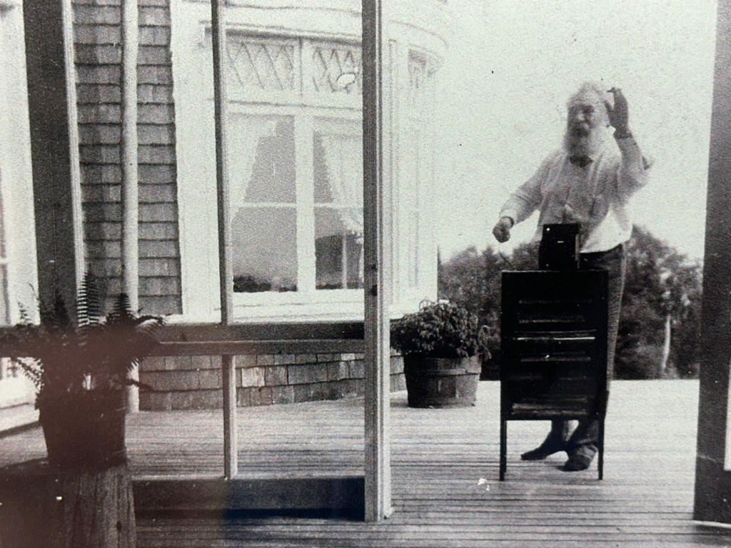
Baddeck and Alexander Graham Bell. After a one-day reprieve from fog, mist and rain, it returned on our second day which gave us a good excuse for some indoor activities. We were staying near Baddeck (near is relative), so we went into town for lunch and visited the Alexander Graham Bell National Historic Site and learned all sorts of interesting facts about the inventor of the telephone.
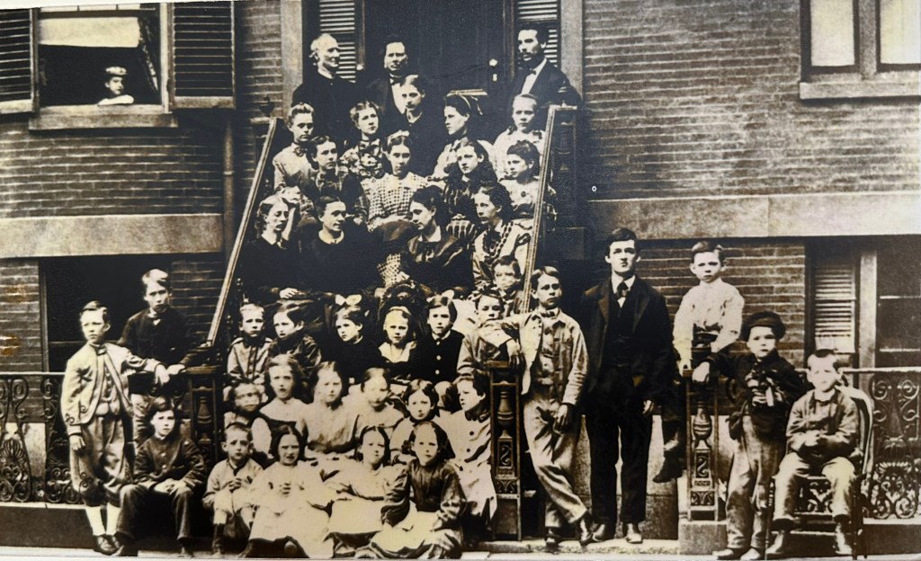
Bell was from Scotland but lived in England and the United States before moving to Cape Breton Island. He and his wife, Mabel, established a summer estate near Baddeck in 1885 after his invention of the telephone. At the estate were research labs where Bell worked with deaf people, including Helen Keller. Bell’s father had worked with the deaf. Both his mother and wife were deaf. It was this experimentation with human perception of sound which helped lead to the invention of the telephone, through a somewhat accidental discovery that sound could travel across a wire and into an adjacent room.

The Bell Telephone Company eventually went on to become the phone company AT&T. Bell loved to plan and experiment with inventions, but lost interest in commercializing them. The telephone was the exception. And while his patent on the telephone was challenged 587 times over 18 years, it was never done so successfully. These challenges, however, inspired Bell to take better notes during his creative process.
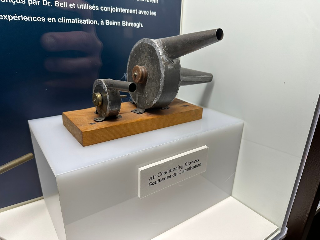
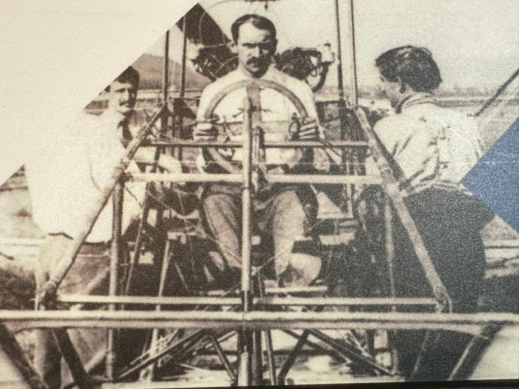
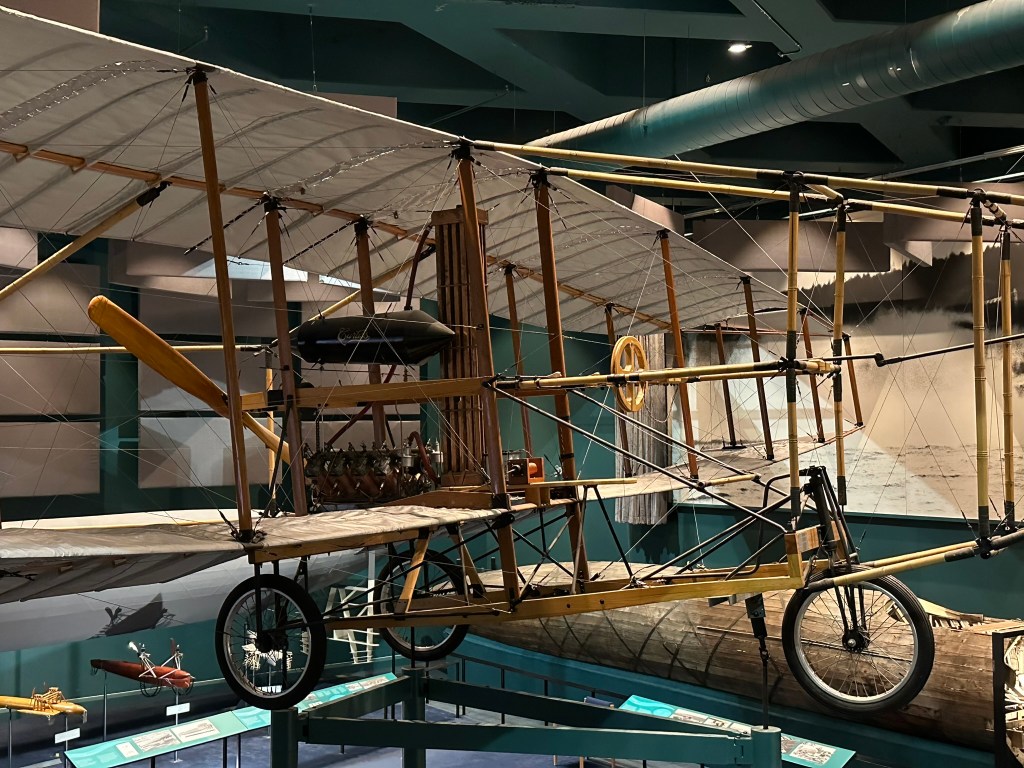
After moving to Baddeck, Bell continued to invent. He hated the summer heat, so he invented an early air conditioner. He invented a device to desalinate sea water to make it drinkable. He was convinced that there was a relationship between the number of nipples on an ewe and her ability to give birth to twins, so he tried breeding multi-nippled sheep (while the nipples part came to fruition, it didn’t lead to a multi-offspring generating sheep). He developed a metal detector which was used to try to find a bullet in the body of President James Garfield after his assassination attempt. The device worked, but because the metal springs on the bed threw it off, doctors were unsuccessful in extracting the bullet leading to Garfield’s death. Bell also helped found the Aerial Experiment Association (AEA) in Baddeck which developed tetrahedral box kites and led to the first Canadian flight of 7 minutes and 51 meters.


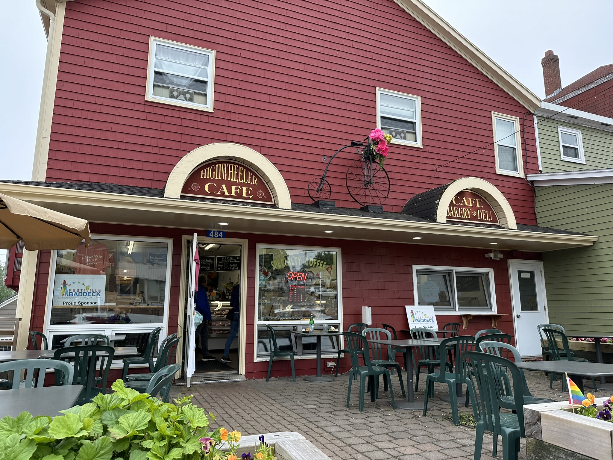
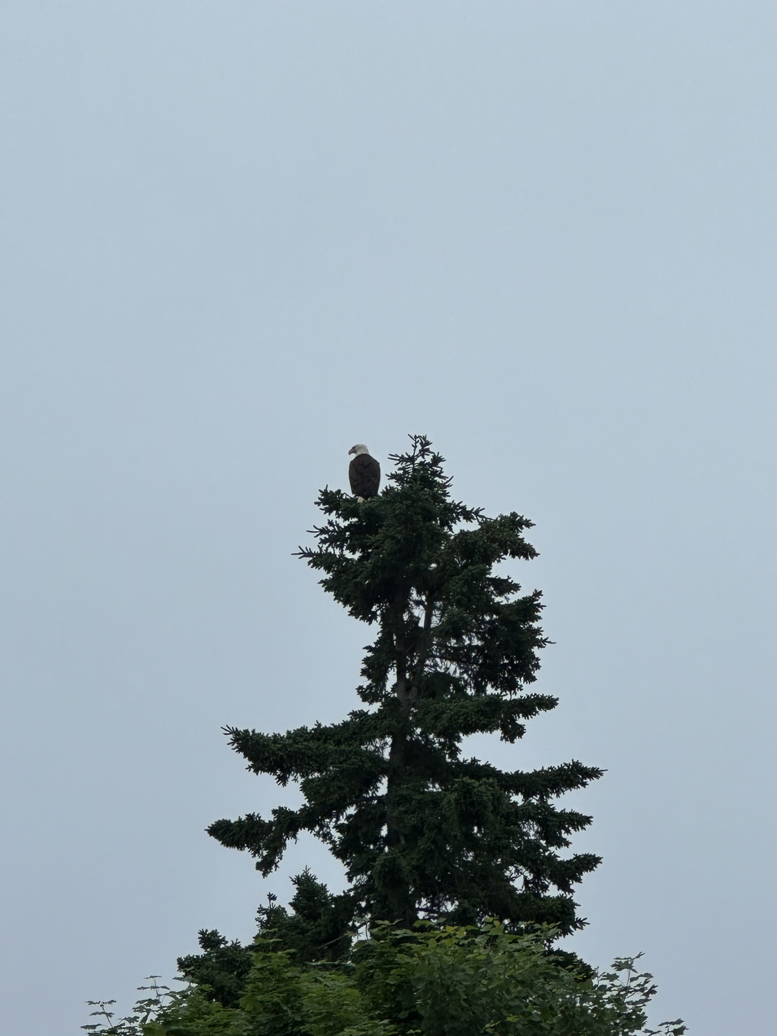
Full of fresh information, we asked the receptionist at the museum for a tip for lunch and she sent us to the Highwheeler Cafe and Bakery where she said that “she would eat lunch every day, if she could”. It was a solid recommendation. As we left town, we saw a bald eagle perched atop a tree then diving to the pond below for fish. When the weather gives one lemons, one must make lemonade.
Meat Cove. On our first full day, the rain had pulled offshore, and the sunrise woke us early as it streamed in through the curtain-less windows (every single Nova Scotia Airbnb we’ve stayed in has had no bedroom curtains, so we were up with the chickens and the early birds daily).
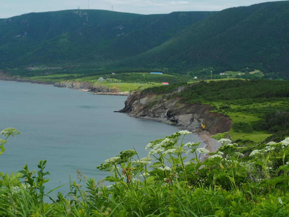
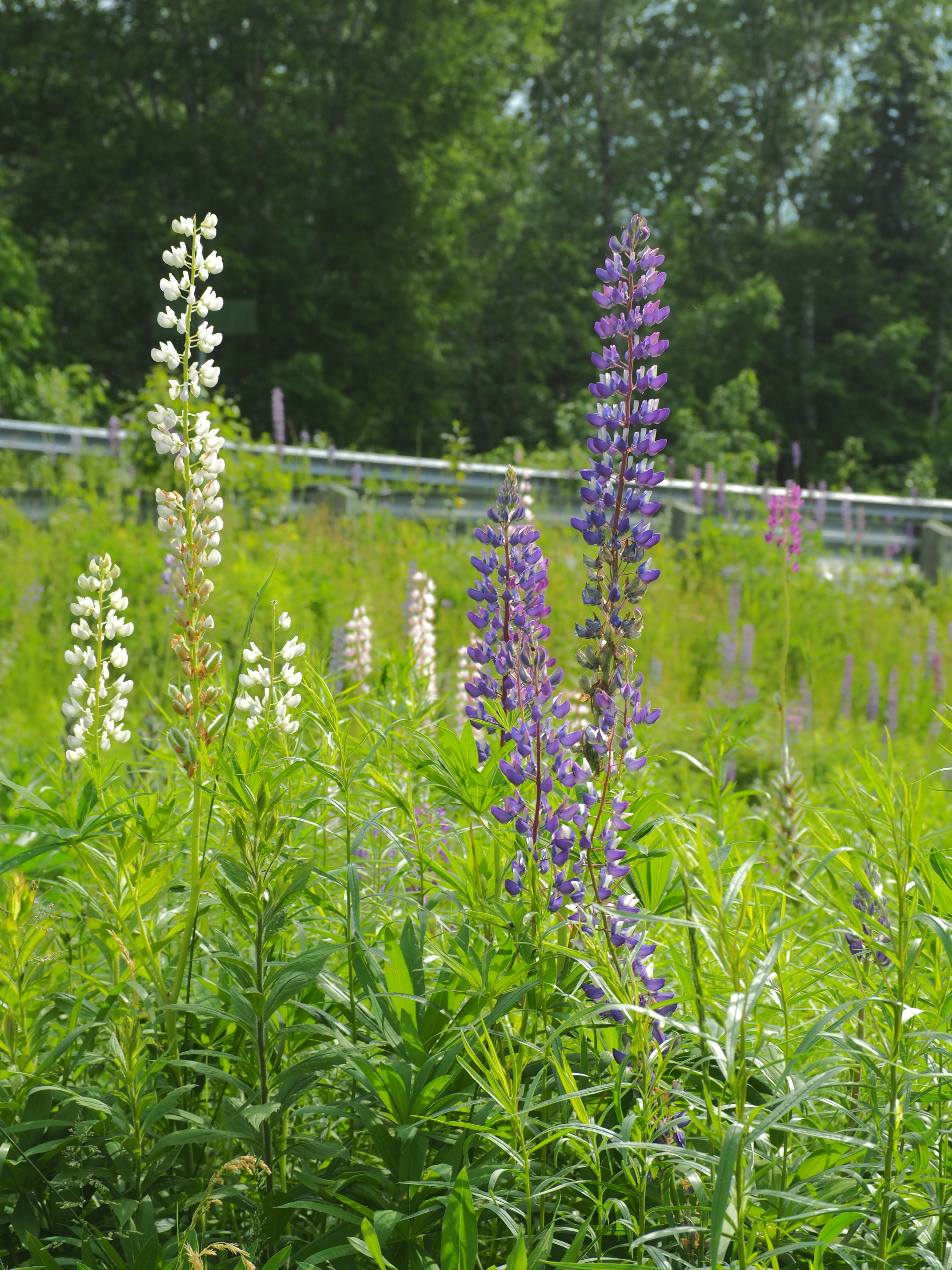
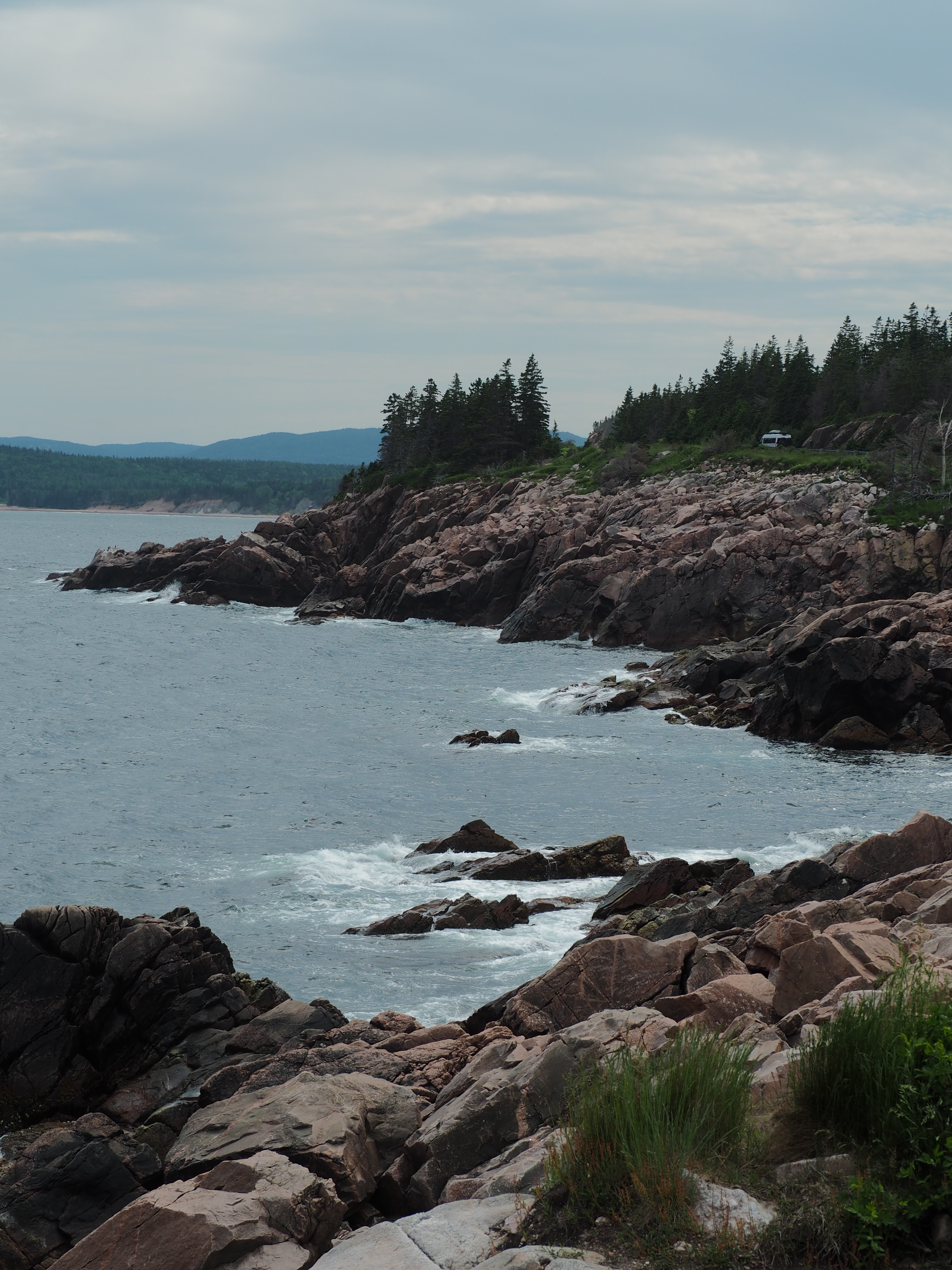
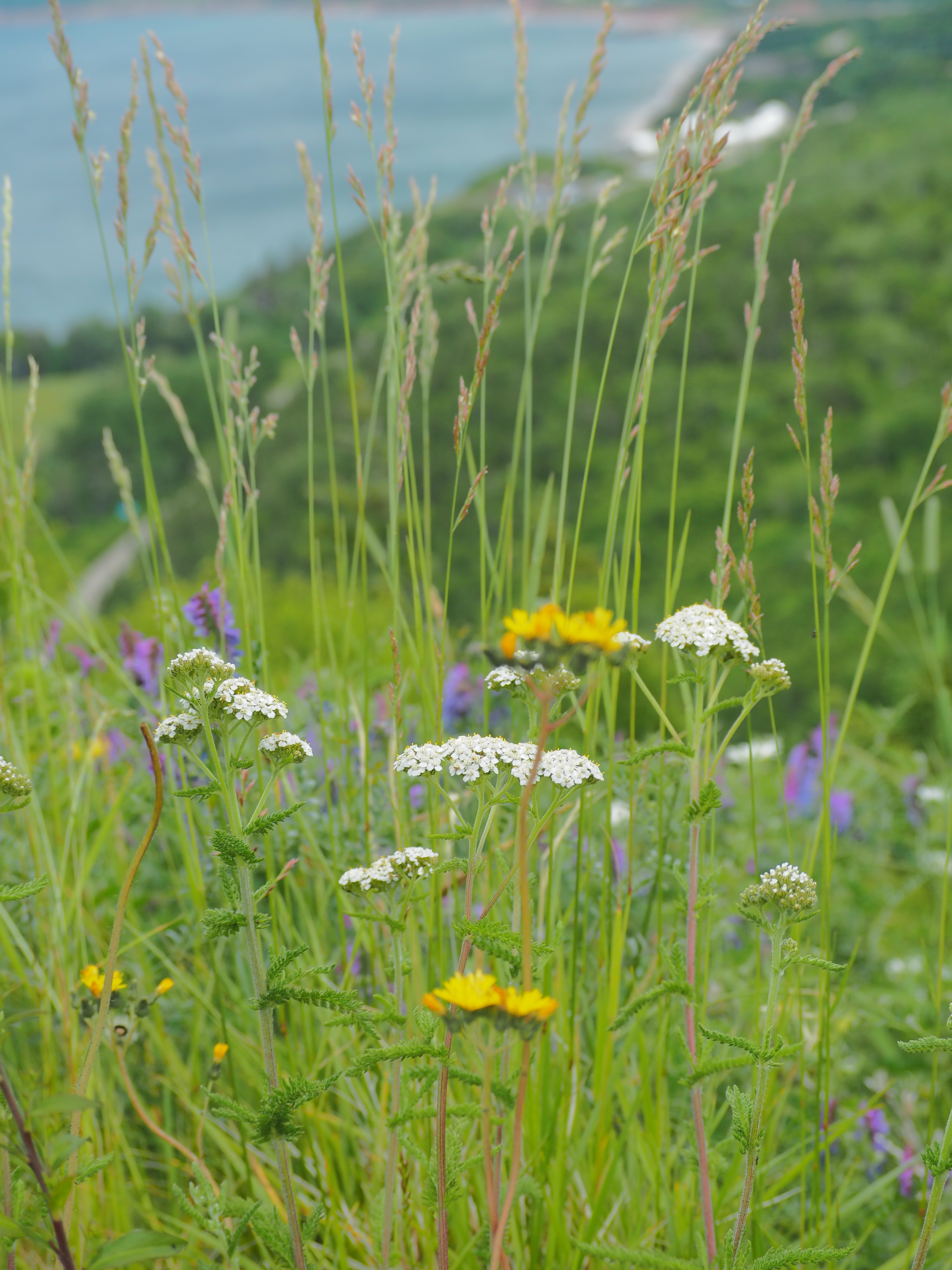
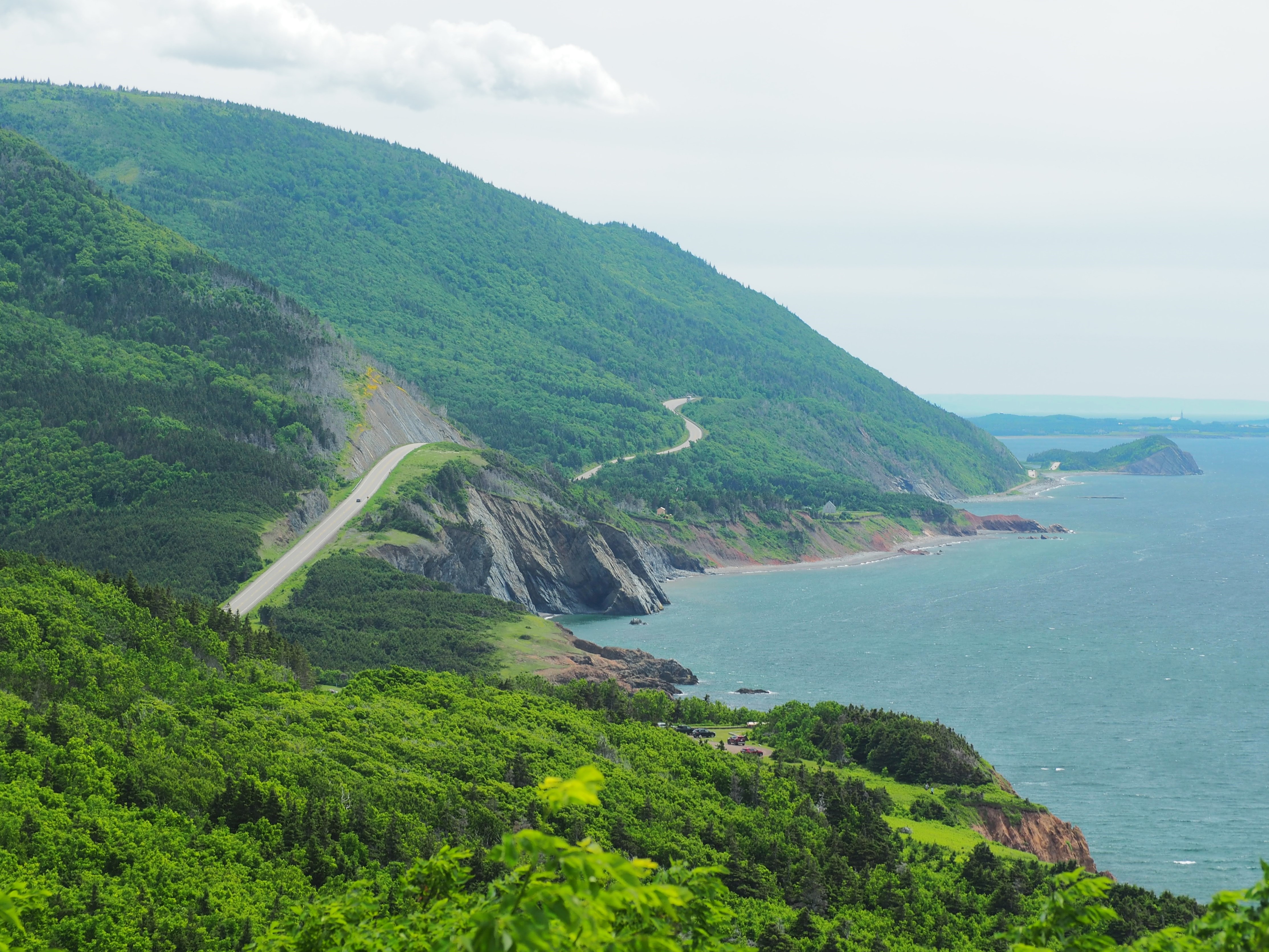
I set out on the northeast path of the Cabot Trail, winding my way up the coastline past beautiful purple, yellow and pink lupines which lined the roadway. Initially, the road was pretty but somewhat unremarkable until I wound my way up a set of curves to the Pathend Brook lookout. I pulled over, with everyone else, and looked back in the direction from which I’d come. Wow.
It was just the beginning.
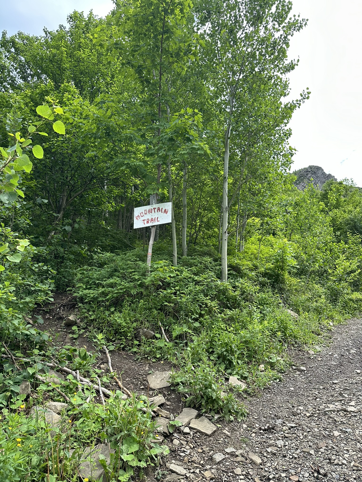
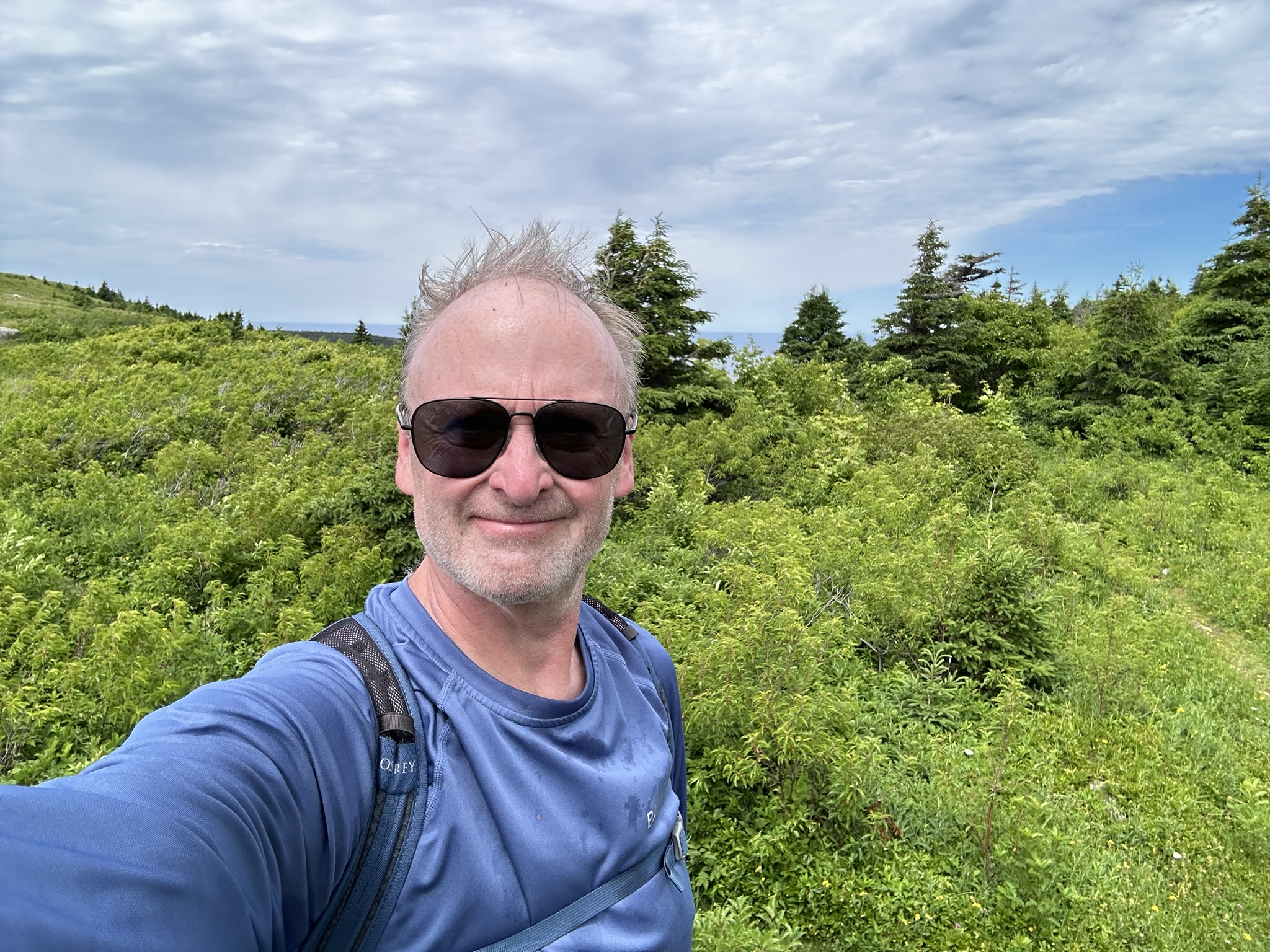
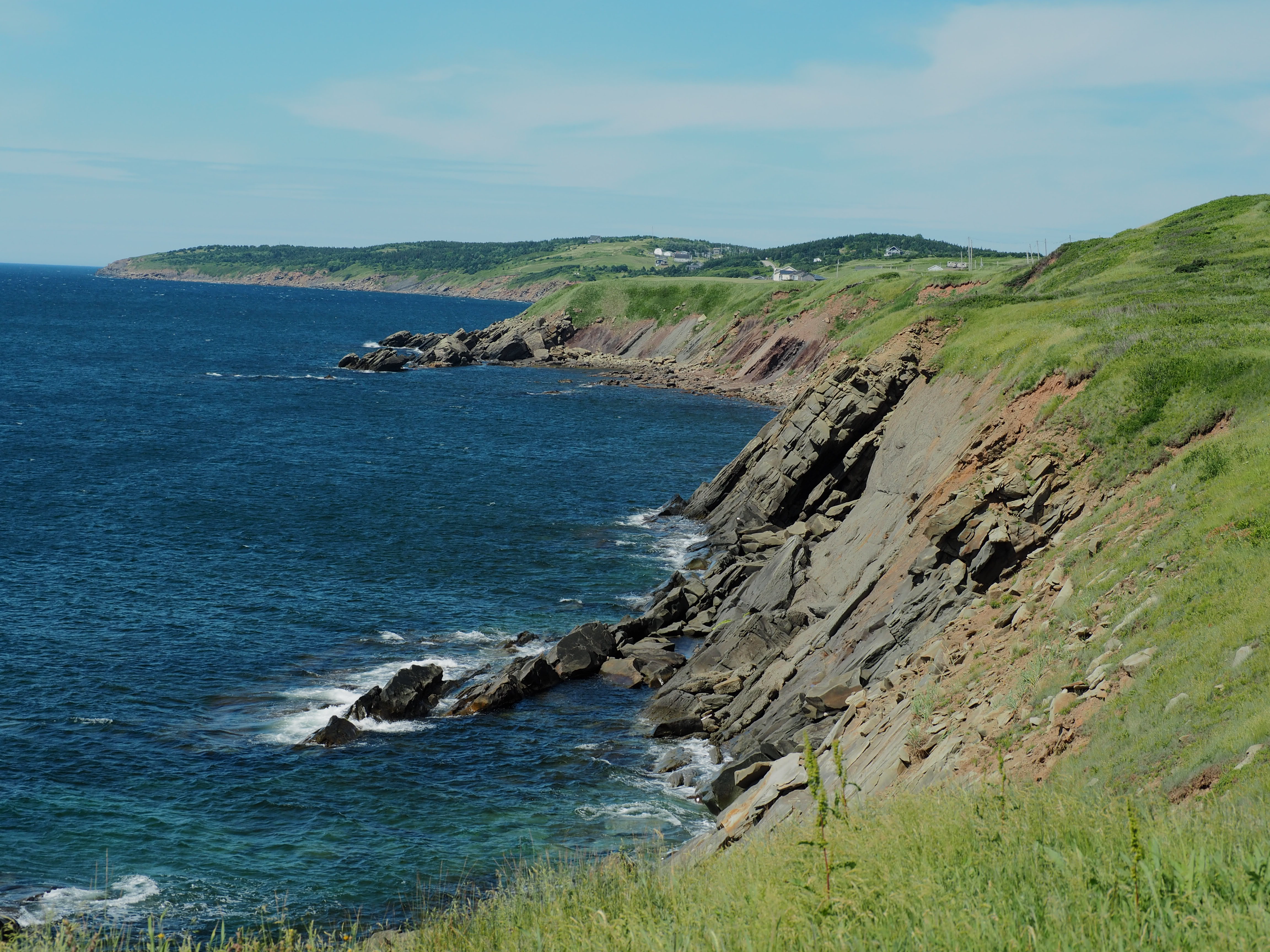
I continued past little Ingonish and then off the Cabot Trail to my destination near the northernmost point of the island: Meat Cove. Driving past where my phone told me the trailhead of the “Mountain Trail” was (mostly because it didn’t look like there was any parking lot), I had lunch by the campground, which was not crowded, but somewhat bustling. There were many hikers continuing up the dirt road which made me wonder my phone had navigated me correctly, but I turned around and went back to the trailhead anyway. I did find the parking lot, but it was unsuitable with lots of washout, so I parked on the road and began my 1.25-mile climb. Helpful rope guardrails line the steepest parts as you climb up through birch and maple forests until you reach an overgrown section which requires a little bushwhacking near the top where the trees end.
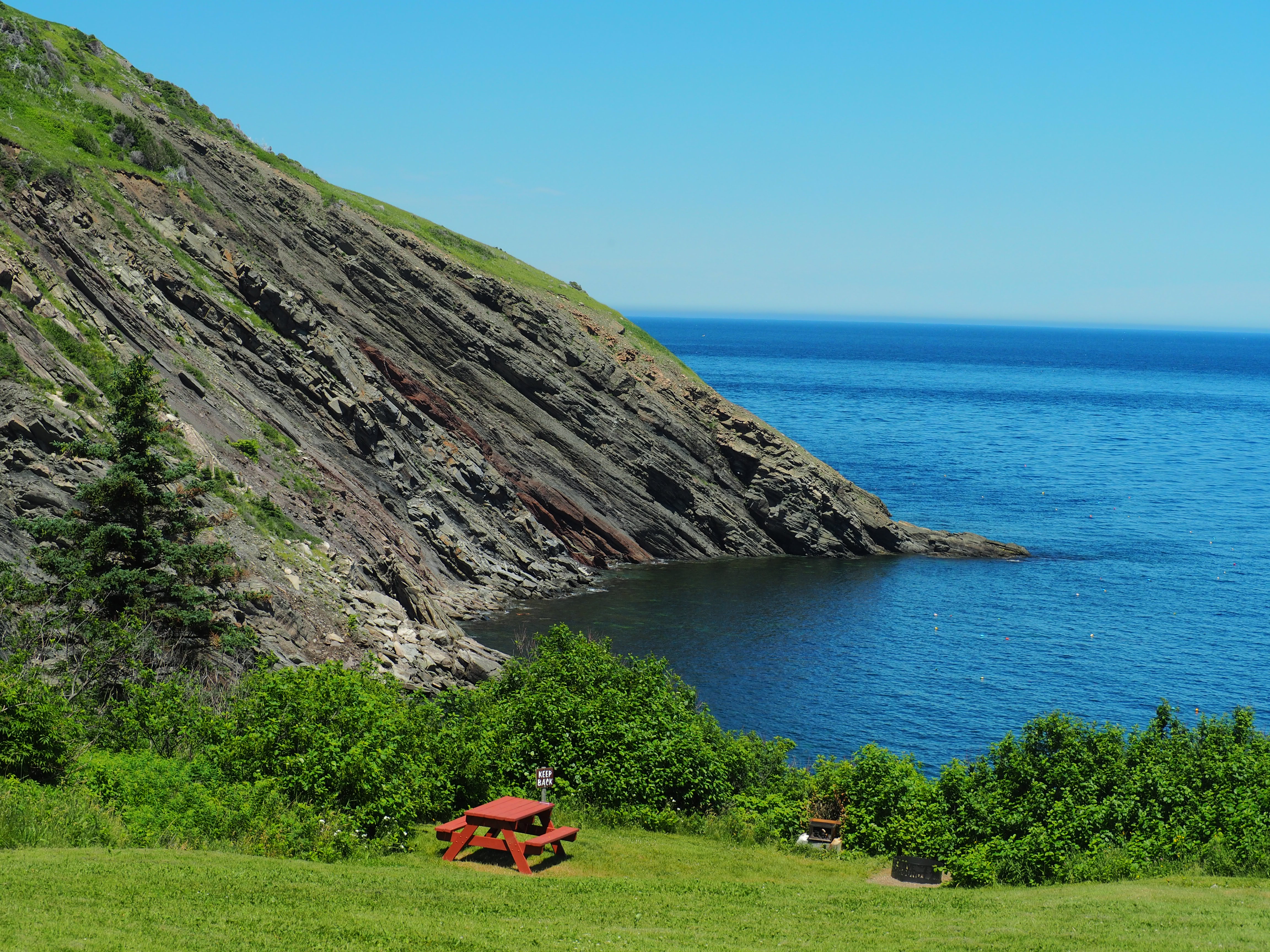
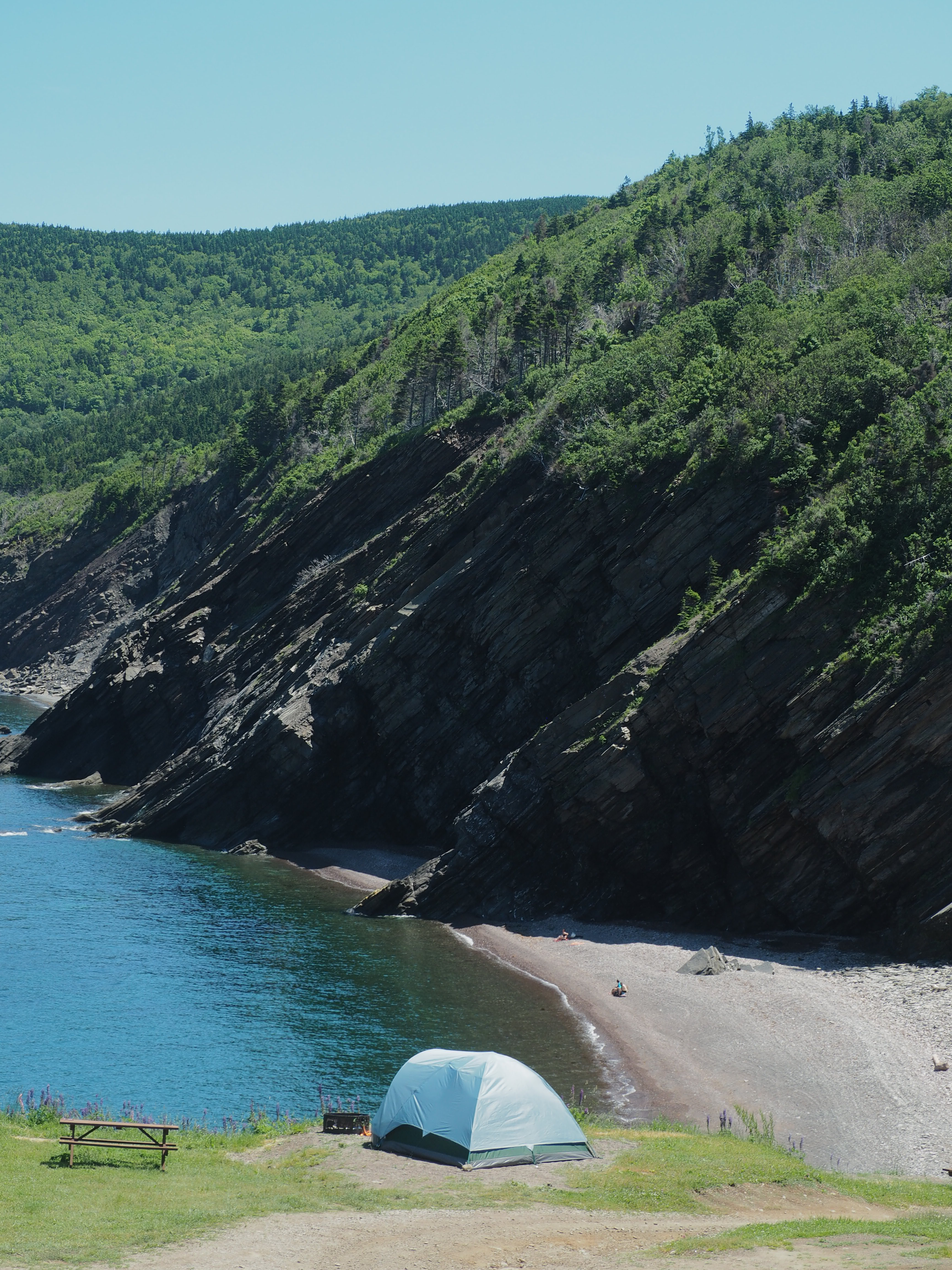
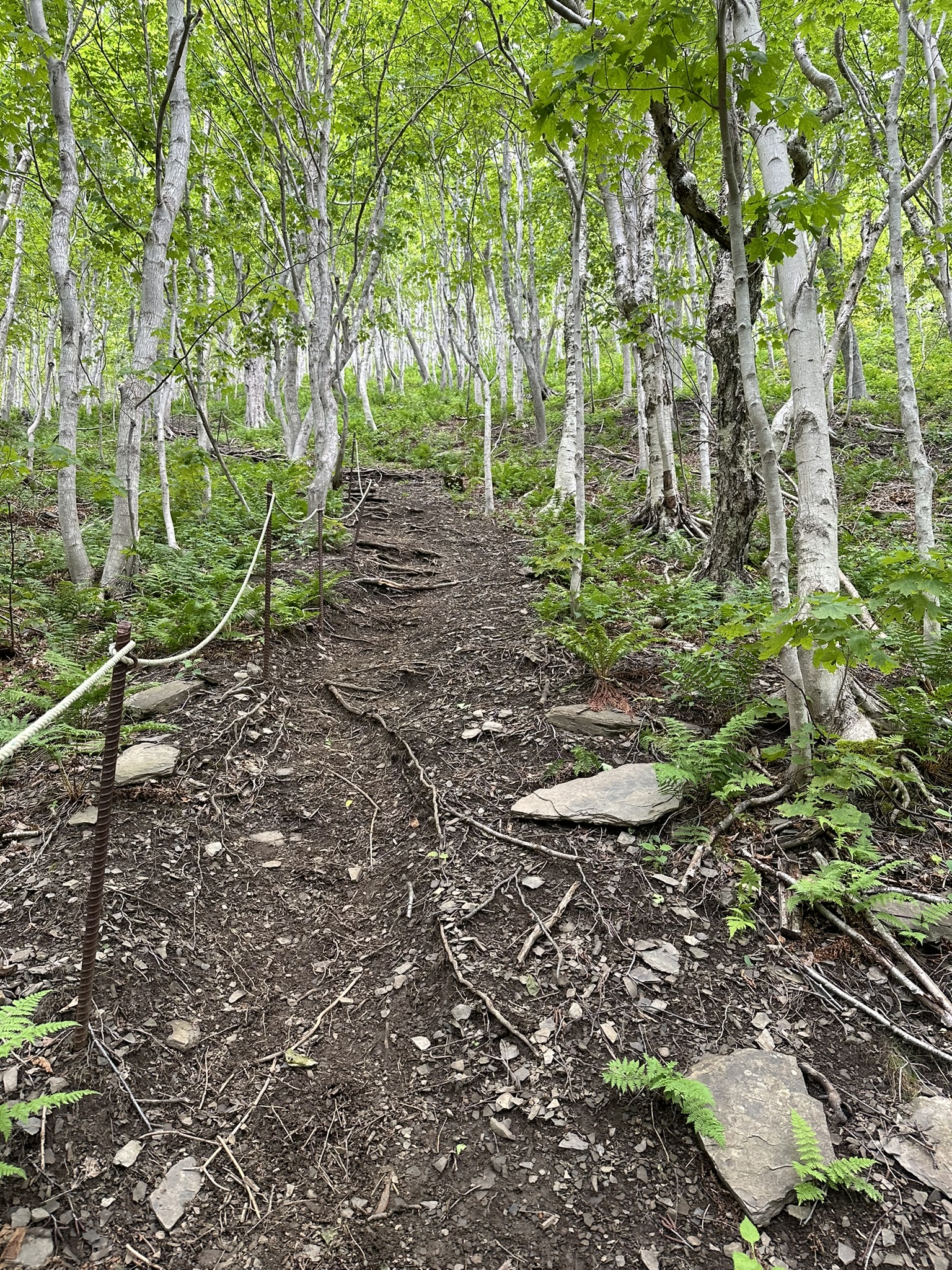
Meat Cove and the Mountain Trail
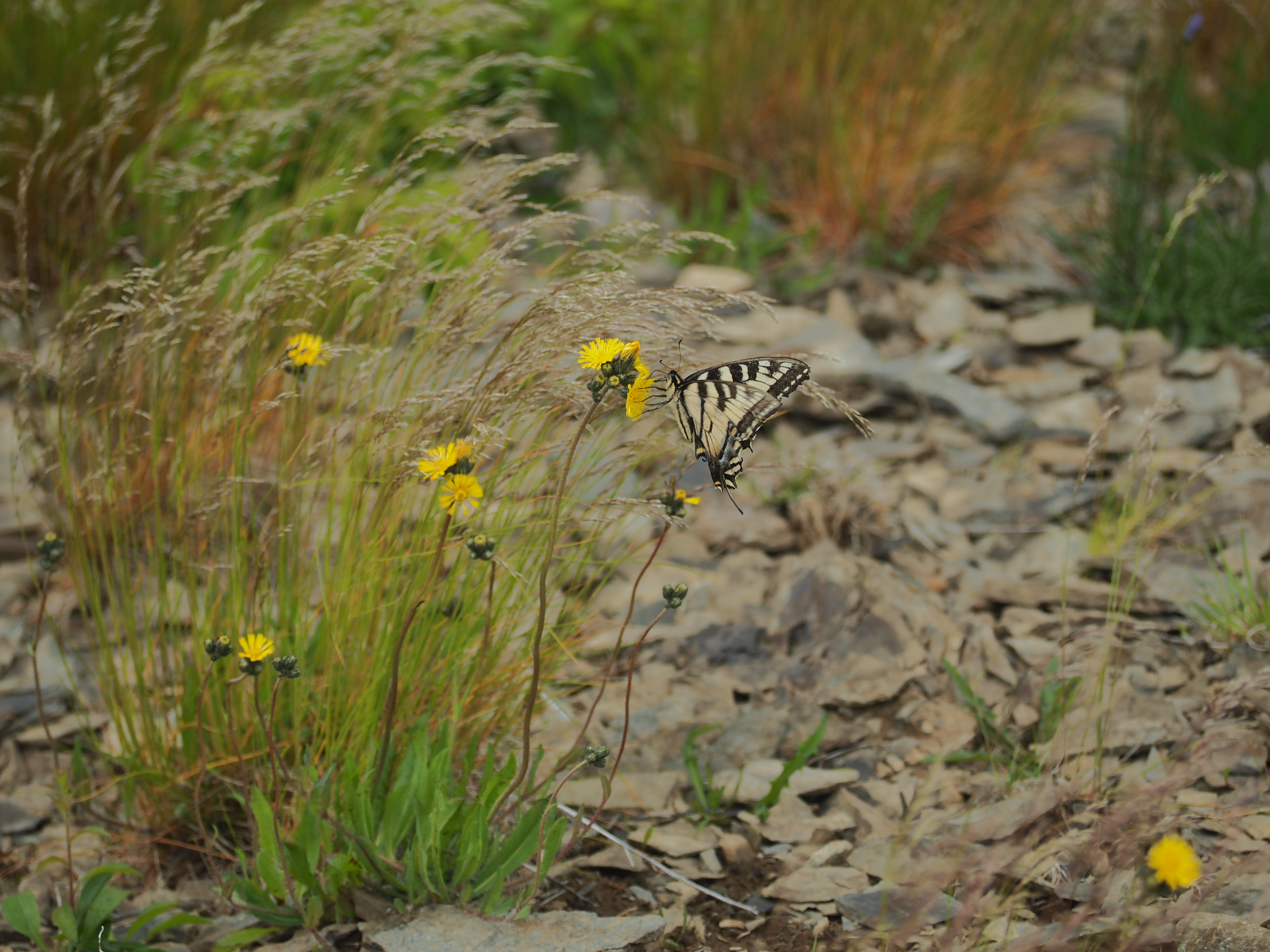
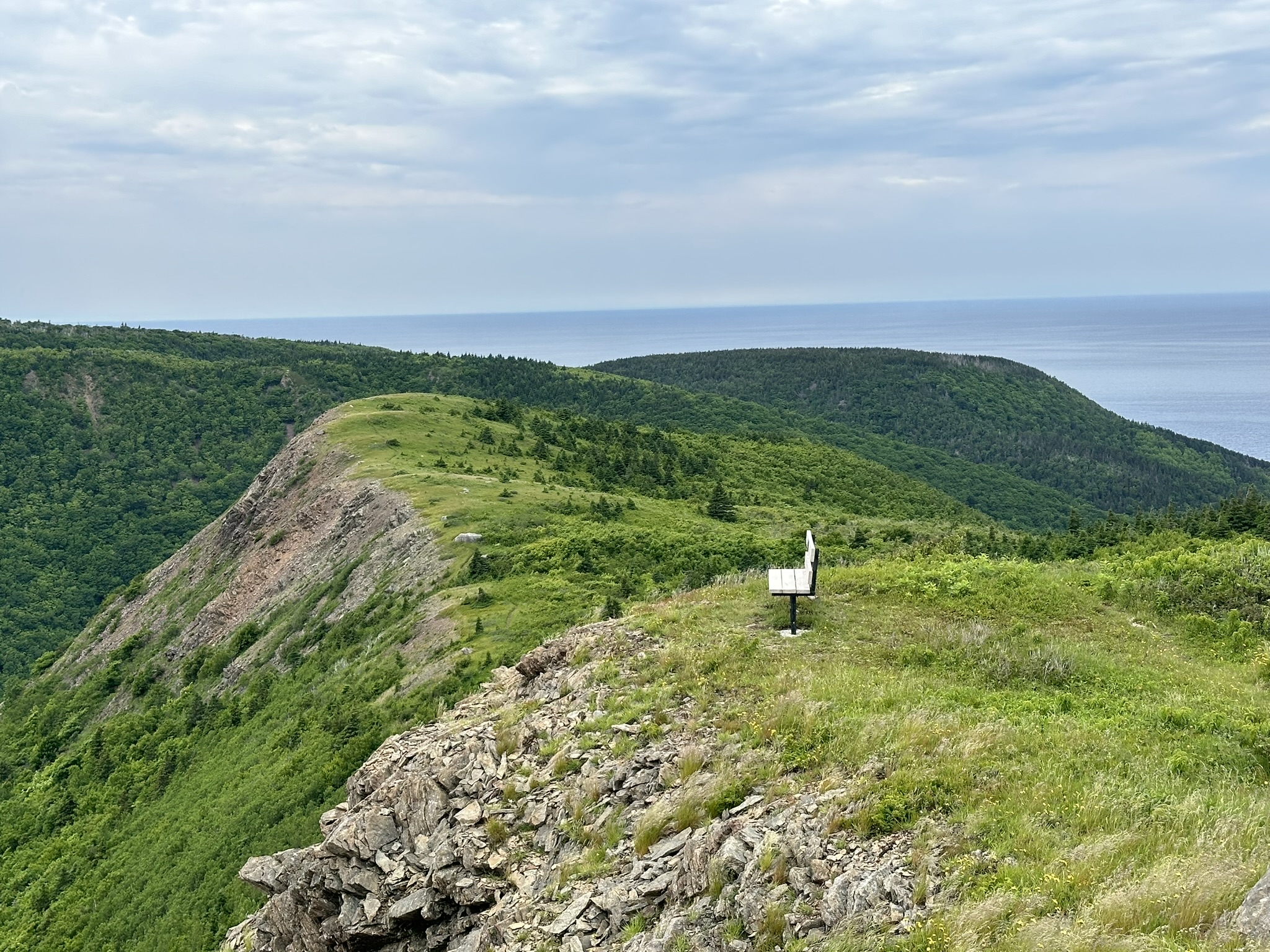
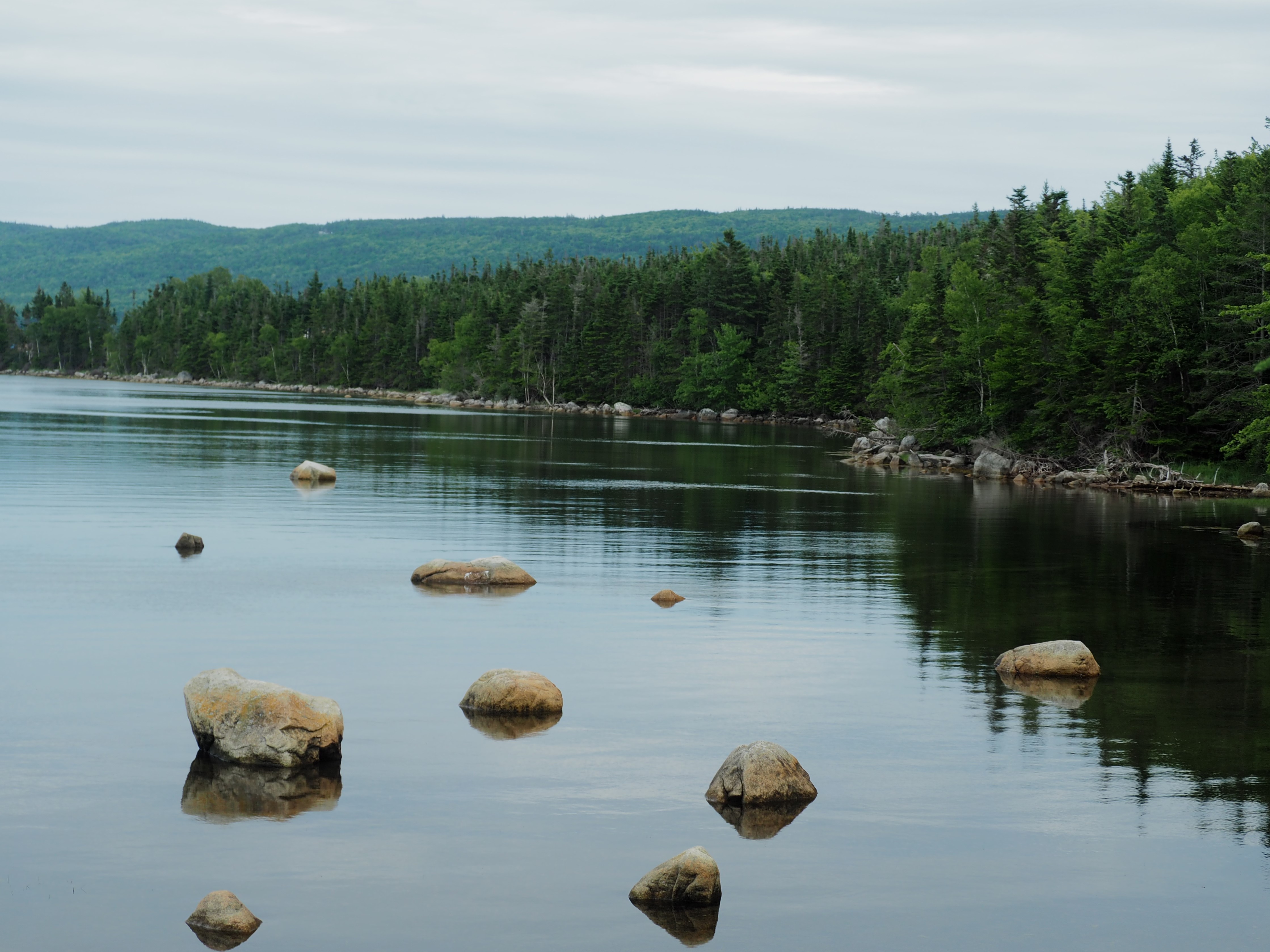
As the trail opened out into a more high-alpine terrain I was all alone with the butterflies, a welcome breeze and the sounds of the stream below making its way to the ocean.
Chasing Waterfalls. The rain cleared out again for our third day, and we set off in the afternoon to explore a couple of short trails through the woods to some waterfalls. The first, Uisge Bàn Falls was in all the “things to do lists”. It was a mostly wide, moderately flat, well-maintained trail with only a bit of scrambling towards the top, right before you reach the falls. Despite being popular, it was far from overrun.
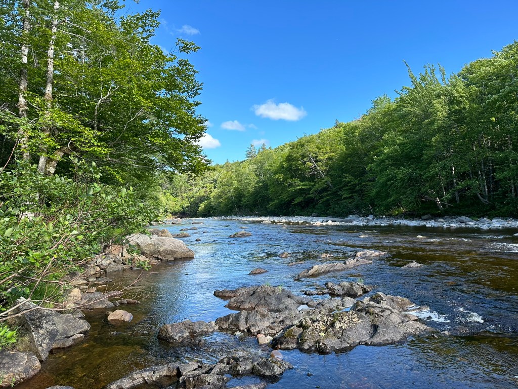
The second trail was to Little North River Falls (there was a sign to the “Big North River Falls” which seemed to point into the woods with no evident path). It dropped down from the parking lot where it got muddy in several places and finally ended at the falls where we watched a fly-fisherman trying to catch his dinner.
Both are moderately easy trails and the black flies, which can be pretty horrific on the island, were not.


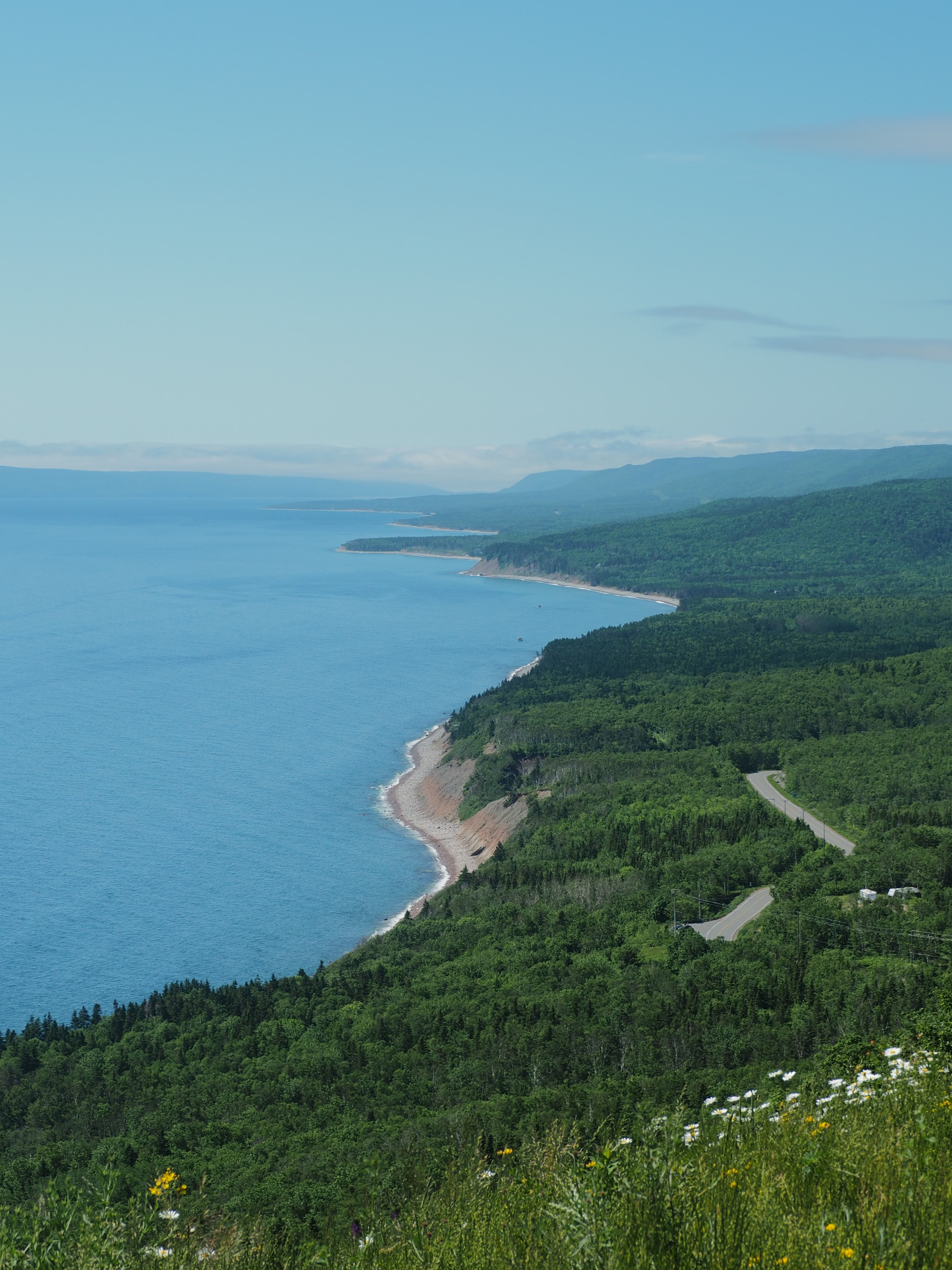
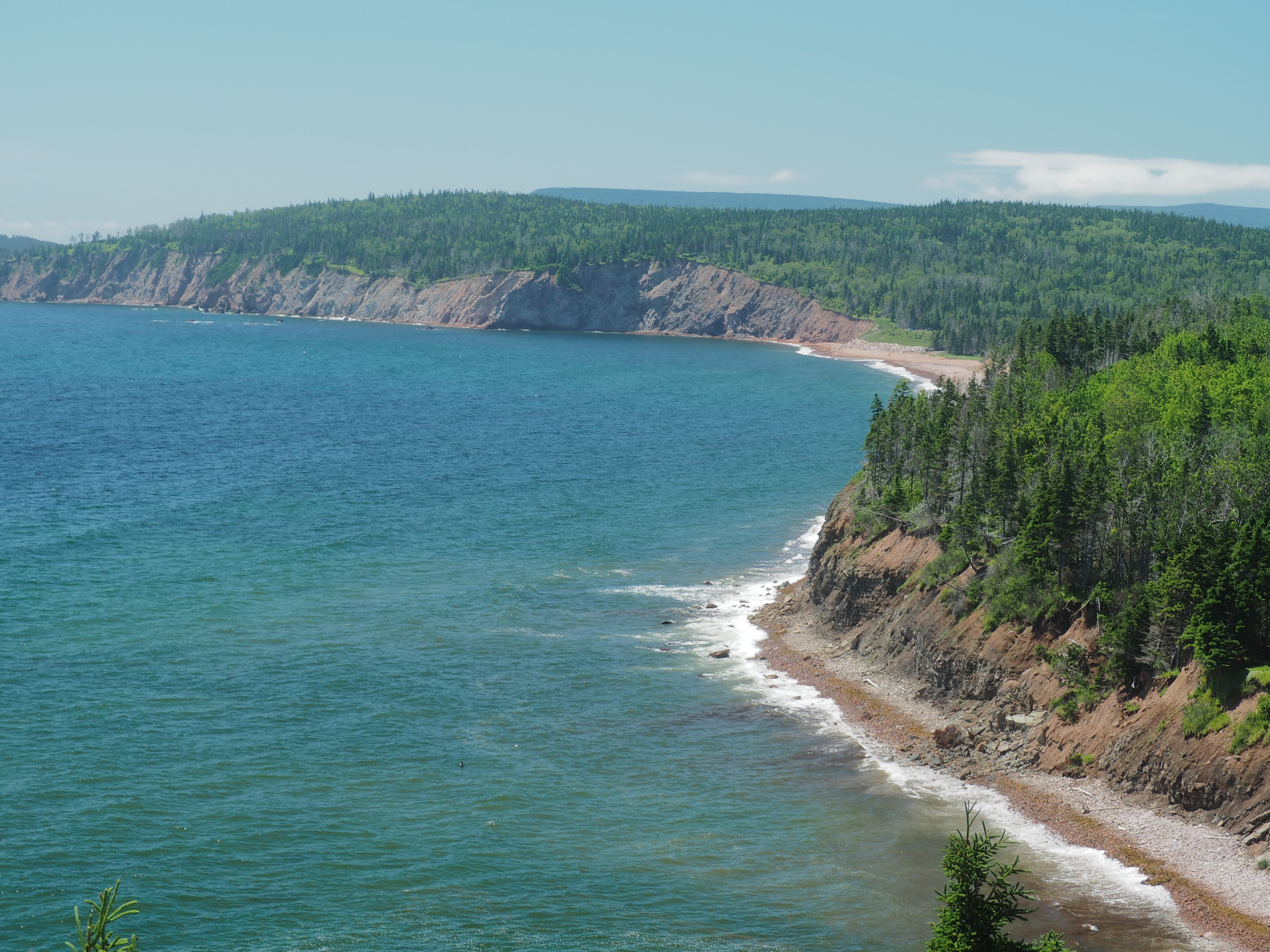
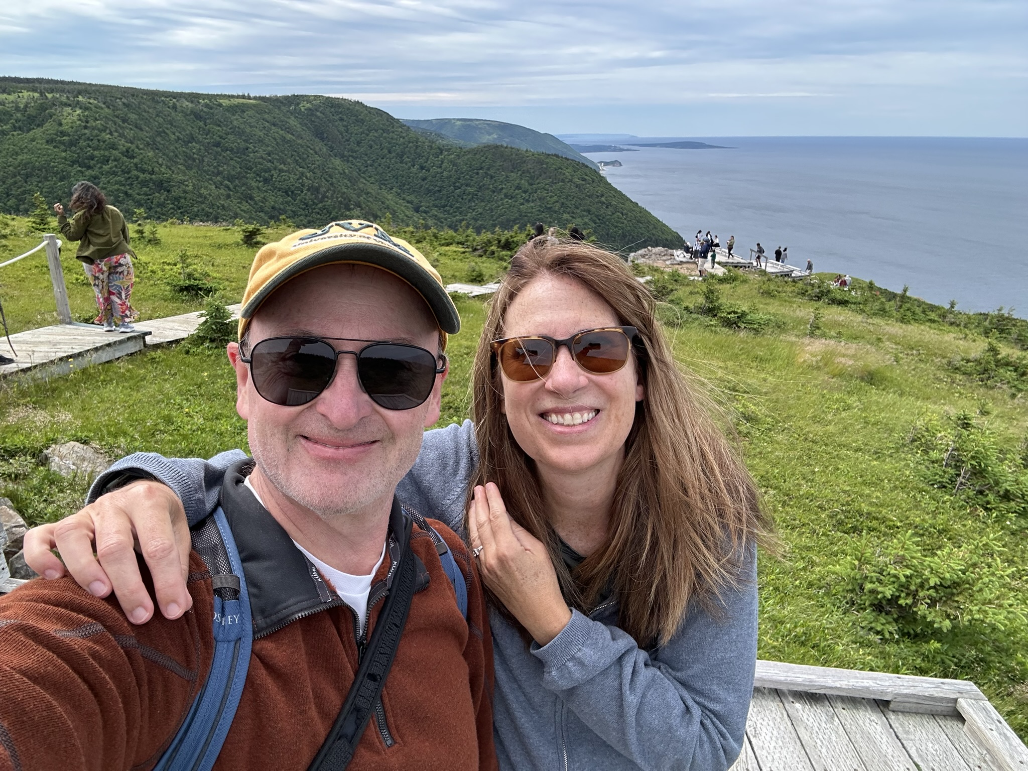
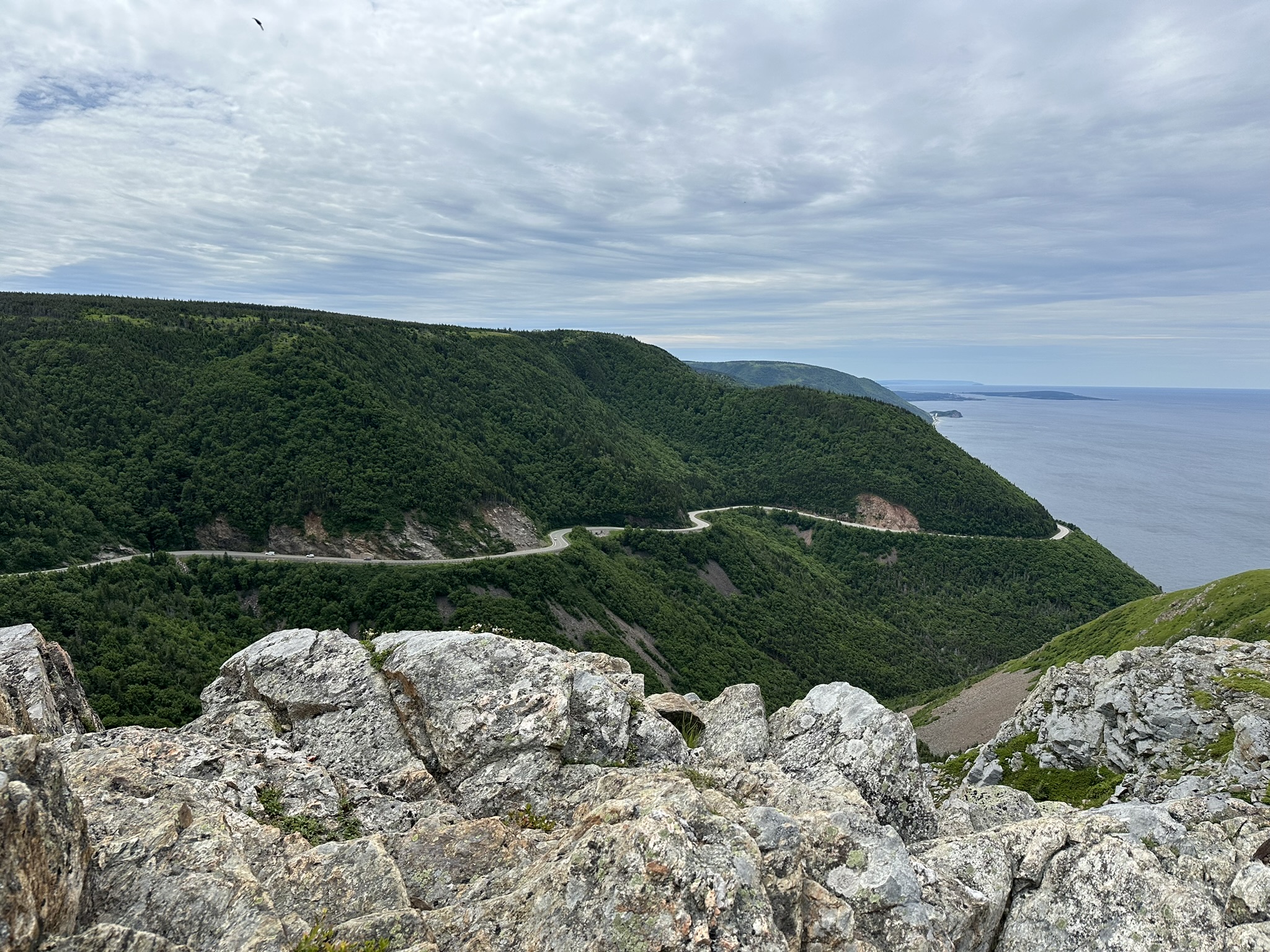
Skyline Loop. For our last day, we chose to hit the northwest side of the Cabot Trail. We set off in the morning to visit the Skyline Trail. If you google things to do on Cape Breton Island or the Cabot Trail or Breton Highlands National Park, this trail is likely to come to the top of the list. We arrived around 11am and the queue was short but growing. The park staff manage it extremely well, I must say. First, you must have a park pass (which you can purchase easily either at the visitor’s center or a drive-through station as you enter from the south), and they do confirm it. If the main parking lot is full, they ask you to pull to the side and wait in the overflow lot and as cars leave, they permit the same number of cars to enter in the order in which you arrived. This not only keeps the aggressive parking behavior to a minimum, but it also manages the flow of hikers on this popular trail.
We set off in the opposite direction of the map on AllTrails working our way counterclockwise through the forest to open marshy fields and eventually to the hills high above the coastline. Our direction worked to our advantage as we were swimming upstream from most of those who had elected to do the loop version of the trail (there’s an out-and-back option which just brings you to the views along the same path as the loop) and we didn’t have to pass by many people going in our direction on our walk out.
We arrived at the boardwalk which takes you down to the viewpoints and worked our way down where the trail overlooks the coastline, and you get to see why everyone comes. If you choose to go, get there early, as the line was already queuing back to the road by the time we left.

We drove north to Pleasant Bay where we had lunch on the outdoor patio with views of the Gulf of St. Lawrence (which was surprisingly empty) at the Rusty Anchor and then spent the rest of the afternoon meandering south the way we came along the Cabot Trail. When all was said and done, we’d covered about 80-90% of the Trail during our stay.
Our Tips: Cape Breton Island has a lot to offer with beautiful scenery, great seafood, friendly people, Irish music and interesting history. If we were to give any advice:
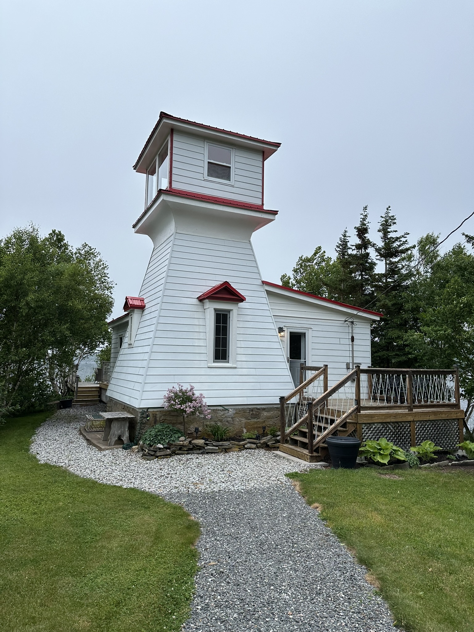
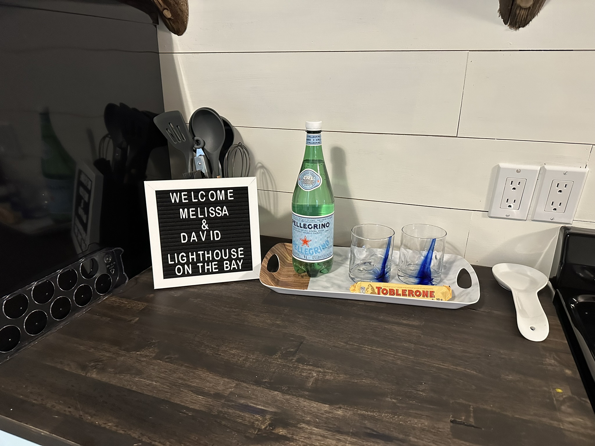
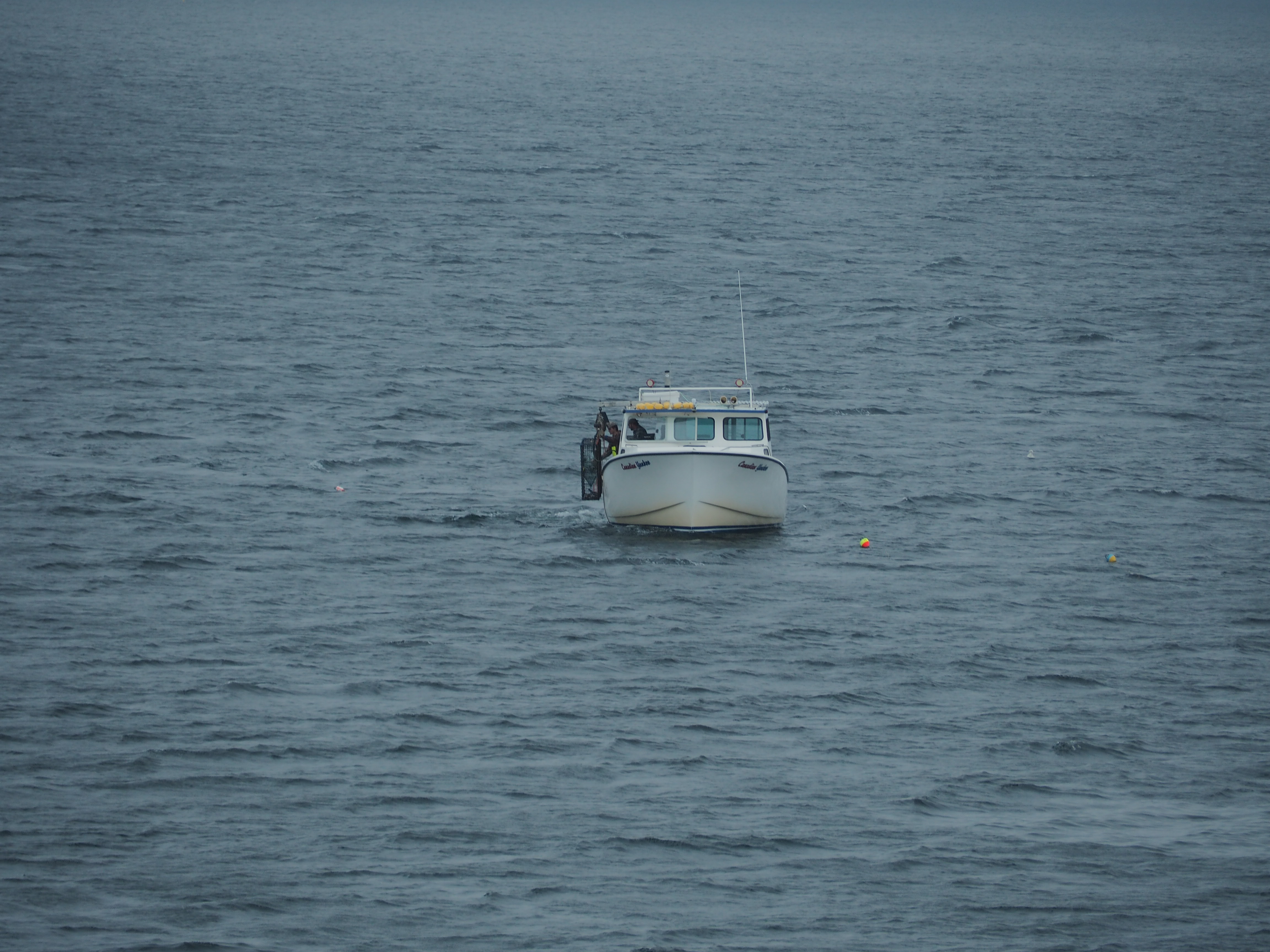
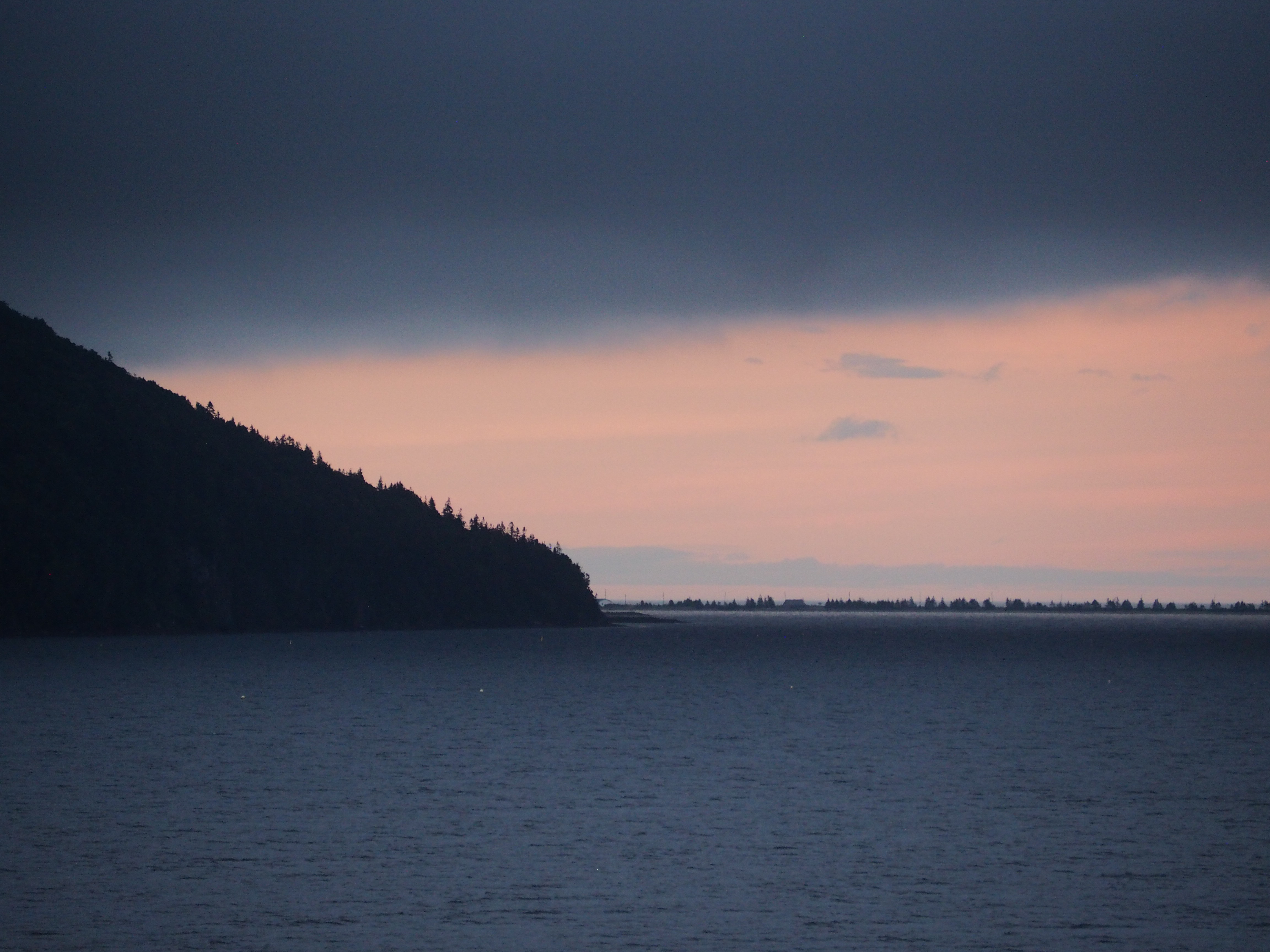
1. It would be best to stay somewhere more remote where you can enjoy the scenery and wildness of its landscape from your own front door. We stayed in a fantastic little converted lighthouse Airbnb with a 5-star host near basically nothing. We got to watch bald eagles, sunsets and lobstermen checking their traps from our living room, patio and lighthouse tower. This remoteness meant a lot of driving, but with scenery this good it was hard to complain. We would not stay in one of the towns, none of them really did much for us or made us want to stay there, so take advantage of being able to stay remote if you can.
2. Finally, there’s a lot to do and explore, so don’t shortchange the island. It takes some doing to get here, so plan at least 3 nights because if you want to do the Cabot Trail properly (which is why most come) you’ll want to break it into a couple of days like we did or allow for a very long, full day in order to stop off in villages, do some hikes and just take in the marvelous views.
While the world is large, and we still have a lot to see of it, we’ll be back.
Sources:

0 comments on “Scouting out the Cabot Trail of Cape Breton Island, Nova Scotia”